uavservice.ca
Aerial Imaging and Monitoring
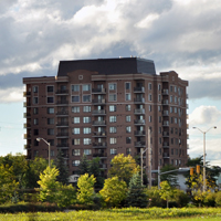

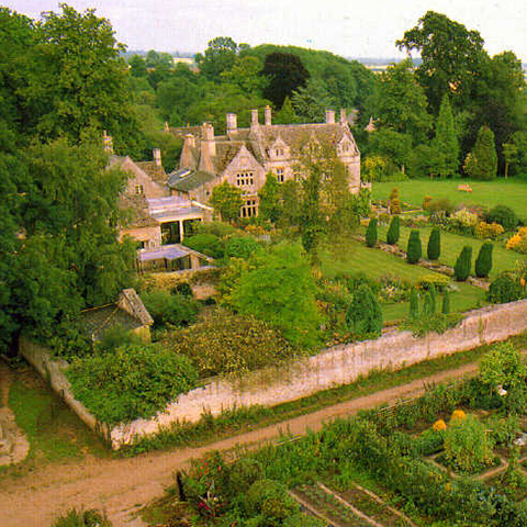
Real Estate
Aerial & Terrestrial
Photography & Videography
We provide real estate photography services to real estate agents and real estate owners. Our real estate photography services are offered in customizable packages according to our client’s preferences. Our services include taking aerial pictures and videos of to be listed or currently listed real estate. We provide our clients with a complementary Internet web page featuring comprehensive visual tours as well as 360 degrees views of property, in addition to the real estate specifications. We implement HDR method to produce high definition pictures from real estates and landscapes. We also use Unmanned Aerial Systems/Vehicles (UAS/UAV also called flying robots) to capture aerial photographs and videos.
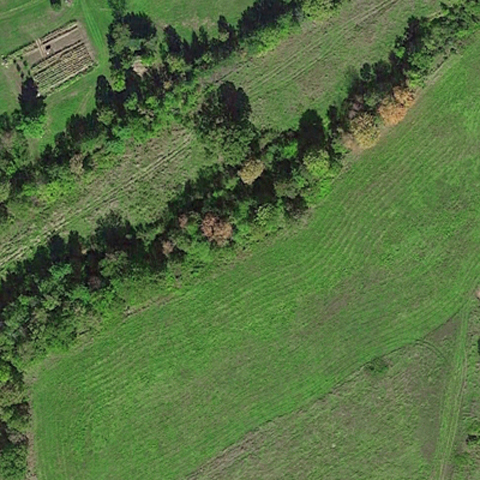
Agriculture
Precision Agriculture
Crop Imaging
One main line of our services is precision agriculture. We use our Unmanned Aerial Systems to capture aerial still images and videos. Images can be taken in visual spectrum or other spectra of light. We use NIR imaging techniques to monitor crop fields. These images are converted in to NDVI (Normalized Difference Vegetation Index) and analyzed by special software to determine the status of the crop. We provide farmers and farm management staff with timely information such as pest infestation, plant diseases, vegetation stress levels and soil moisture. This is a very fast and cost effective remote sensing data collection which can be used as a farm or natural resources management tool. The aerial video streams from our UAV systems can be used for herd management and ranch surveillance.
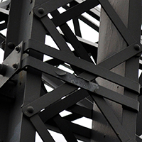
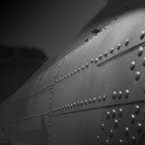
Inspection
Industrial and Scientific
Aerial Inspection
UAVs can be used for industrial inspection. Our industrial inspection service utilizes UAV systems to visually inspect structures such as bridges, power lines or pipelines. These systems can fly over or hover near structures and send high resolution images or videos to operators. These images and videos can be used to inspect and discover defects and faults such as oil leaks or cracks on the transmission towers or their suspension insulators. UAVs can also use special imaging systems to find thermal leaks or small cracks on buildings or other structures. We also provide agricultural UAV services to the farm management personnel. Data gathered by UAVs in various stages of agricultural operations from land preparing to harvest is analyzed and presented to the farm managers. These data analysis can show pest manifestation in its early stage. It can also provide timely information about crop growth stage, irrigation system condition and aridity, and also crop diseases and nutritional deficiencies.
Surveillance
Aerial Surveillance
and Monitoring
UAV system are used for patrolling in many parts of the world. Our UAVs can monitor an area by aerial patrolling autonomously or by remote control. They can provide night vision active surveillance and can be used in search and rescue operations. Their thermal imaging capability is a quick, effective and low cost solution for disaster relief and rescue operations. They can be used as aerial patrol around buildings, warehouses and acreage homes to provide active perimeter security monitoring though live video links.
UAV Service is an Ottawa-based Canadian technological service provider. Our main ambition is to facilitate management, improve production, and protect resources of our clients. To do this we use the latest robotic and imaging technologies for aerial photography, terrestrial photography and remote sensing services. We implement HDR method to produce high definition pictures from real estates and landscapes. We also use Unmanned Aerial Systems/Vehicles (UAS/UAV or flying robots) to capture aerial photographs and videos. Images can be taken in visual spectrum or other spectra of light. We combine Thermography techniques with aerial imaging services. These techniques can be used for visual inspection or investigating thermal and mechanical properties of subjects such as power lines, pipelines and structures. UAV systems can also provide services in broadcasting, security monitoring, precision agriculture, disaster relief and search and rescue operations. They can also be used for marketing purposes. Our B2B services utilize the modern technologies of fast paced autonomous and RC robotic systems. The industry is growing quickly and markets are being developed rapidly. Our services cost a fraction of similar services using full-sized aircrafts with a pilot and crew on-board.